Some of the best hiking in the Washington, DC and Northern Virginia areas is in Shenandoah National Park. Boasting epic views of the Blue Ridge Mountains and numerous sections of the famous Appalachian Trail, this national park is also known for its incredible waterfalls, which are the centerpiece for many hikes.
In this guide from guest contributor Julie Chickery, get the scoop on the best waterfall hikes in Shenandoah National Park and find out which ones are the best fit for your adventure!
Shenandoah National Park is home to some of the most beautiful waterfalls in the country, but you’ll have to reach them on foot.
There are several popular waterfall hikes to choose from, ranging in difficulty from easy to strenuous. They wind their way through forests and along serene mountain streams, providing hikers with stunning views along the way.
Each waterfall has its own unique character, from the towering Overall Run Falls, which you’ll admire from a distance, to the wide run of Lower Whiteoak Falls, where you can frolic in the water. No matter which trail you choose, the power and beauty of Shenandoah’s waterfalls are sure to amaze you!
Know Before You Go
The most important thing to understand about Shenandoah National Park before planning your waterfall hike is how the park is laid out.
Only one road runs through the park: Skyline Drive. With a 35-mile-an-hour speed limit, it takes about 3 hours to drive the full length of this 105-mile scenic road that runs along the Blue Ridge Mountains. For that reason, you may want to focus on waterfall hikes in a specific area of the park.
The park has four different entrances to make it easier to reach your intended destination. From north to south, they are: Front Royal (mile 0), Thornton Gap (mile 31.5), Swift Run Gap (mile 65.6), and Rockfish Gap (mile 104.6). The following waterfall hikes are listed by their location and mile marker in the park.
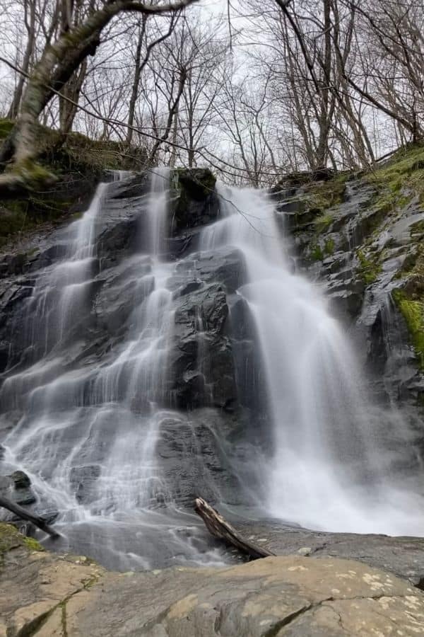
Overall Run Falls – Mile 22.1
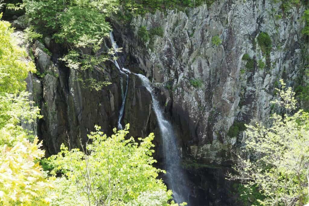
Located in the northern district of Shenandoah National Park, Overall Run is the tallest waterfall in the park.
The Overall Run Falls hike begins at a parking area just beyond the Mathews Arm Campground registration booth. It offers dense canopies of old growth forest along the Appalachian Mountains and takes you to a large rock outcropping with stunning views of the Shenandoah Valley below.
You’ll actually see two waterfalls on this 5.1-mile (round trip) hike: the 29’ upper falls and the 93’ Overall Run Falls. They are truly something to behold, but you will view them from a distance. If you turn around and retrace your steps after enjoying the vista of the falls, you’ll have 1,291’ elevation gain on the return trip to your car.
If you’re up for a longer 9-mile hike with 2,247’ elevation gain, follow the trail down to the bottom where it intersects with the Overall Beecher Connector Trail. You’ll find several small waterfalls and swimming holes offering a great place to take a break, relax, and enjoy the peaceful surroundings.
Looking at the trail map, you can see that there are numerous trails in this area. Depending on how much time you want to spend hiking, you can make it an even longer loop if you prefer. This area is also great for spotting black bears, as it is not far from a campground.
Tip: Spring and fall are the best times to see Overall Run Falls. The trail can get very icy in the winter, and in the summer there is often little water flow.
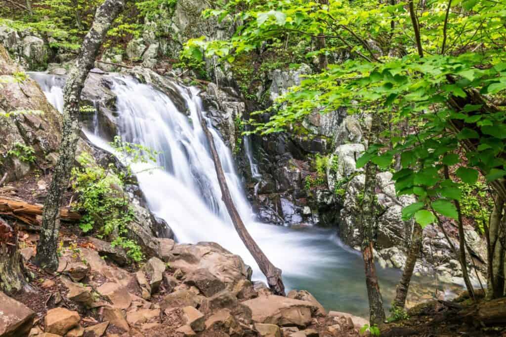
Whiteoak Canyon / Cedar Run – Mile 42.6
Whiteoak Canyon offers the best of both worlds: dramatic falls that you can view from above and below, plus numerous swimming holes if you want to refresh yourself in the bracing mountain water. It also offers the advantage of access from Skyline Drive or from the boundary of the park off Weakly Hollow Road in Syria, Virgina.
From Skyline Drive, you can opt for the shorter 4.6-mile trek through the woods. It follows a creek to the Upper Whiteoak Falls viewing area where you will see the water plummeting 86’. About 2/10 of a mile before reaching the falls observation point, you can enjoy a dip in a shallow pool of crystal-clear water.
The return trip has 1040’ of elevation gain with some steep sections.
The only easy hike among these choices is Whiteoak Canyon’s lower falls from the boundary parking area in Syria. This 2-mile roundtrip hike follows the river, which provides numerous places to stop and take a dip. If you want to make your excursion longer, continue hiking up the trail (it turns steep right after the lower falls).
For those up for a challenge, the Whiteoak Canyon / Cedar Run loop is a more difficult hike but well worth your time and energy. You’ll be rewarded with eight waterfalls, countless small cascades, moss-covered rock ledges, and a few water crossings on this strenuous loop hike that showcases the beauty of Shenandoah National Park.
Tip: All of the Whiteoak Canyon hikes are beautiful any time of the year. As a result, the parking areas on Skyline Drive and at the boundary fill up fast on the weekends.
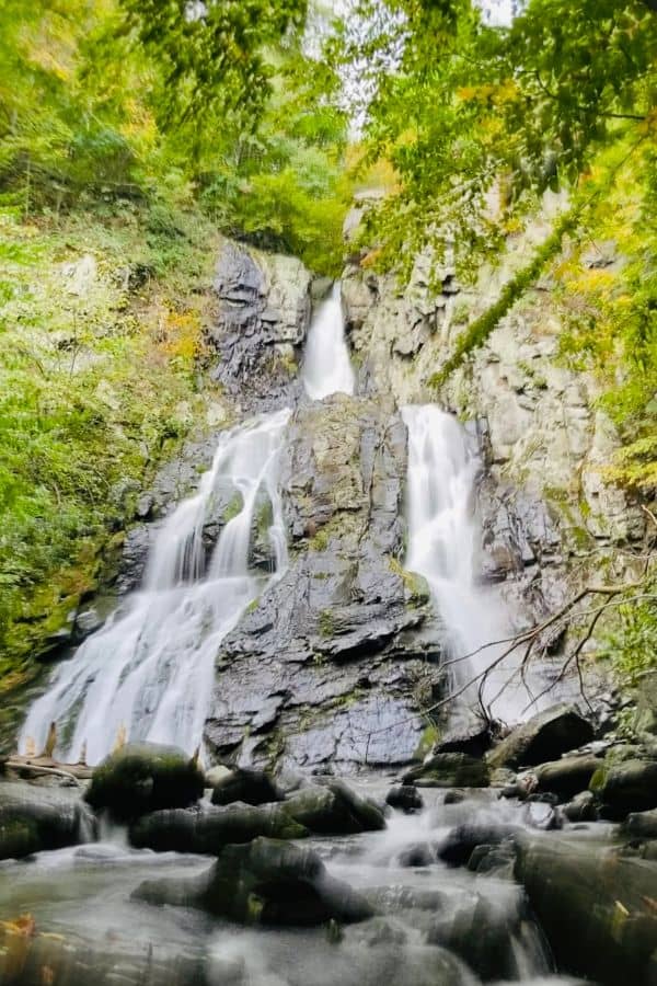
Rose River – Mile 49.4
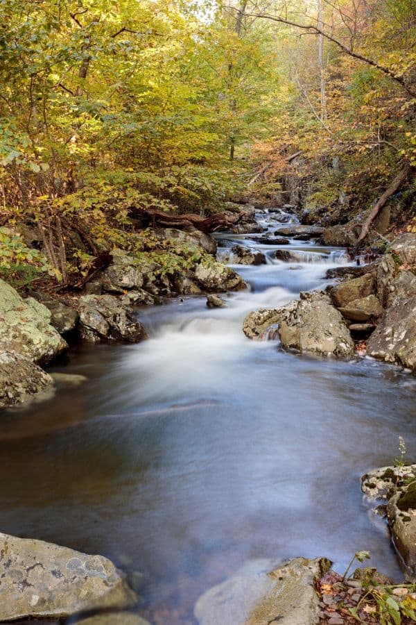
The Rose River trail is a great hike for many reasons, including the stunning 67’ Rose River Falls. The trek also boasts numerous swimming holes and a little bit of history over a moderate 4 miles of trail.
From the Fisher’s Gap Parking Area on Skyline Drive, you’ll hike about a mile on the Rose River Loop Trail before reaching the river. From there, the trail follows the flow of the water for about 1.5 miles, passing a concrete structure that was once part of a copper mine that operated from 1845 – 1850.
You’ll return to the parking area via the Rose River Fire Road. On the fire road, you’ll come across the Cave Family Cemetery, one of approximately 100 cemeteries in the park. They serve as a reminder to visitors that this area was once home to families who were displaced to create the national park.
Tip: For a double feature, about halfway through the hike, you can also choose to add on a quarter mile to the base of Dark Hollow Falls (see below).
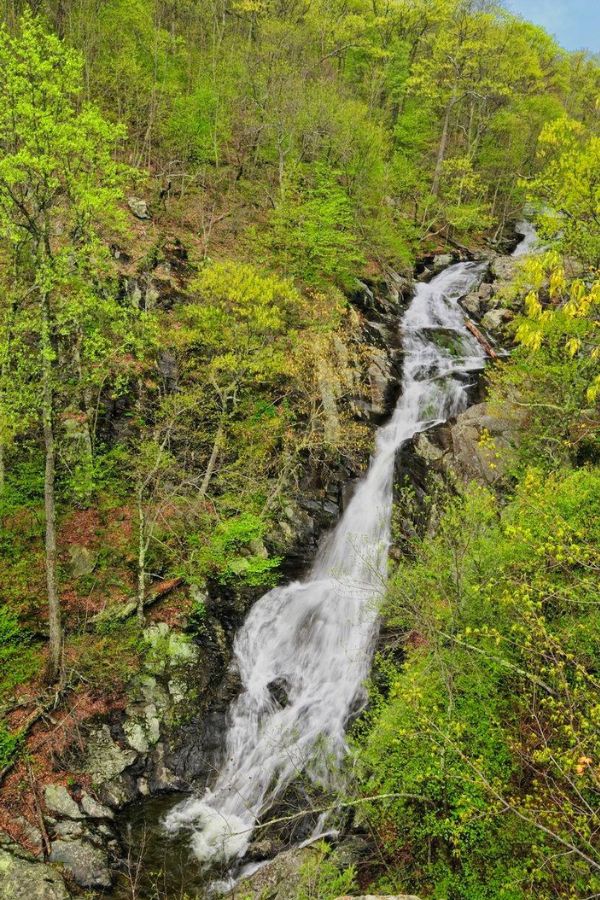
Dark Hollow Falls – Mile 50.7
Dark Hollow Falls is one of the most popular hikes in Shenandoah National Park, not only for its stunning beauty, but also for its location. Of all the waterfalls in the park, it is closest to Skyline Drive.
Just a half mile from the parking lot, you’ll see the top of the falls. For the next quarter mile, you’ll follow the cascades down to the base of the falls where you can even take a dip in the water.
At only 1.5 miles total, this is a short hike, but please note that it is fairly strenuous with a number of steep sections as you ascend 440’ back to your car. The trail can also get wet and muddy, especially after heavy rain, so watch your step. Allow yourself time to stop along the way to enjoy the scenery and catch your breath.
Afterwards, head over to the Byrd Visitor Center to learn more about Shenandoah National Park. Adjacent to the Visitor Center is the Big Meadows Wayside where you can grab a bite to eat. The best time to visit is in the summer if you want to try their famed Blackberry ice cream!
Tip: Dark Hollow Falls trail is one of the few trails in Shenandoah National Park that does not allow pets. In fact, less than 20 miles out of the over 500 miles of trails prohibit pets.
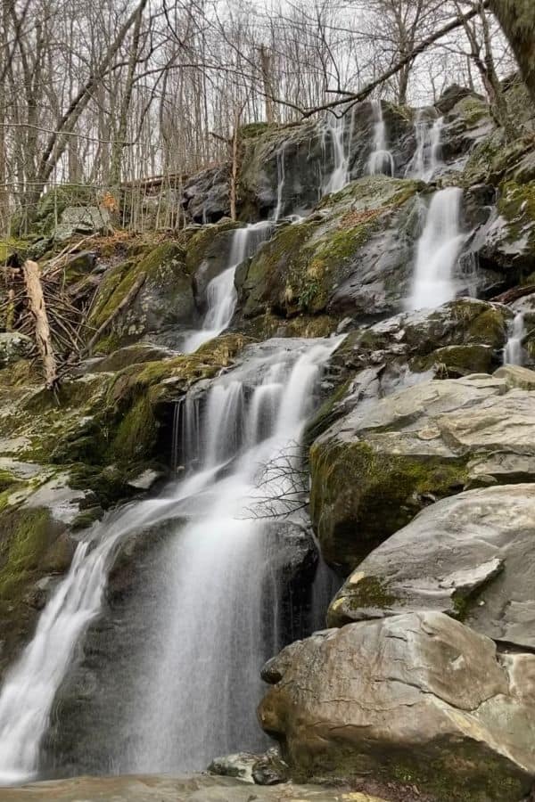
Lewis Falls – Mile 51.2
Lewis Falls is a spectacular 81’ waterfall behind the Big Meadows Recreation Area in Shenandoah National Park’s Central District. You can access it a couple different ways, both of which are steep and rocky.
The shorter option (1.8-mile out and back) is to park at the small parking area just south of the Big Meadows Wayside and take the access path to the Lewis Spring Falls trail. From there, you’ll follow a series of switchbacks to the falls.
If you’re in the mood for a longer hike with a few scenic overlooks, park at the Big Meadows Amphitheater for a 3.3-mile loop, which includes a section of the Appalachian Trail (AT). Just off the AT is the Blackrock summit where you’ll be treated to sweeping views of the Shenandoah Valley and Massanutten Mountain range.
Tip: Many people stop at the small stream crossing at the head of the falls, not realizing you can cross (carefully) and continue the path to a spectacular view of the entire falls in all its glory.
South River Falls – Mile 62.7
South River Falls is a great waterfall hike if you want to enter the park farther south. It is only 3.3 miles from the Swift Run Gap Entrance Station off Route 33 and has a large parking area (South River Picnic Area) with ample room for any size group.
You have two good options for hikes, depending on your preferences. The first is a 2.6-mile out-and-back on the South River Falls Trail to the upper falls. From there, you can view the 83’ waterfall from above.
The second hiking choice is a 4.3-mile circuit hike that goes to the bottom of the waterfall, where you can stand at the base and experience its full splendor before returning on the South River Fire Road. The uphill trip is a gradual 910’ elevation gain.
Tip: This is one of the most beautiful and accessible waterfalls in the park. Pack a lunch and swimsuit (weather permitting) to spend some time enjoying it.
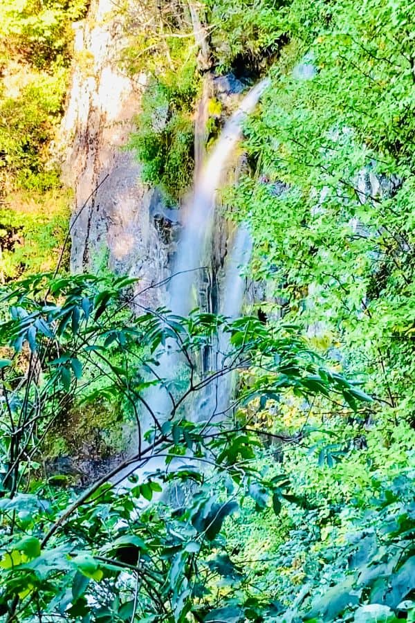
Jones Run Falls / Doyles River Falls – Mile 81.1
If you want to see multiple waterfalls in one epic hike, the 6.5-mile Jones Run and Doyles River Falls Loop in the Loft Mountain/Browns Gap Wilderness area of Shenandoah National Park hosts a trio of falls.
You can also elect to hike one of the shorter out and back trails: the 3.3-mile Doyles River out-and-back or the 3.2-mile Jones Run out-and-back.
Regardless of which option you choose, you’ll hike down from Skyline Drive to the waterfalls and encounter over 1000’ of elevation gain on your return.
All three hikes include a steep path in parts, but the Jones Run trail is rockier and closer to the water, which can result in slick, wet areas. On the positive side, it also includes the 42′ Jones Run waterfall that sits close enough that you can sit beside the base.
The Doyles River Trail offers both the 28’ upper falls and the 63’ lower falls. They are situated farther off the trail, down a steep incline. You can’t access them directly, but you can see them very well, even through thick summertime foliage.
Tip: Combine your waterfall hike with a stay at Loft Mountain Campground and enjoy a short hike over to the Doyles River Trail from there.
* * *
Shenandoah National Park has beautiful waterfall treks for every hiker! Whether you want a short jaunt with young children or a challenging full-day adventure, you can find a hike that fits the bill.